
Site Information
North America – USA – Colorado
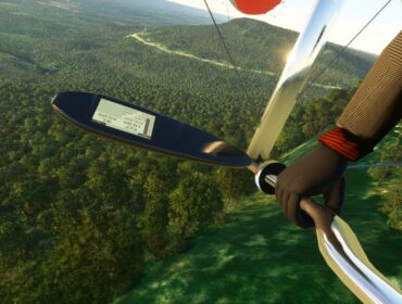
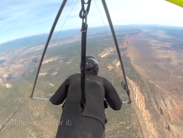
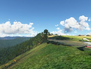
Williams Peak is a beautiful high mountain site in Colorado. There are two primary launches and two landing areas. This is primarily a thermal site though on some occasions it is possible to ridge soar the upper launch1. Williams can be flown as a H2 in morning or late day under calm conditions. The upper launch provides for sled rides of about 7 minutes to the lake LZ. The lower launch may be flown by more a more experienced H2. Midday conditions require a H3 due to the more challenging thermal conditions1. Being a mountain site you must pay careful attention to the weather. It can change very quickly. Wind speeds can go from calm to 40mph in less than 30 minutes1. Good launch skills are critical due to the altitudes of the launches. Pilots coming from coastal sites who are use to one step launches will be very wise to have an experienced mountain pilot coach them during their launch1. You must run out your launch properly. A dozen steps isn’t unusual in lighter winds1. Due to snow on the road to launch Williams is typically unflyable from November to early May. The upper launch can be unreachable until early June some years
Location and Directions
The site is located near Green Mountain Reservoir, about 20 miles north of Silverthorne on highway 91. The launches and landing areas are along NR-200, a dirt road that branches off from highway 9 near Heeney1.
Upper Launch
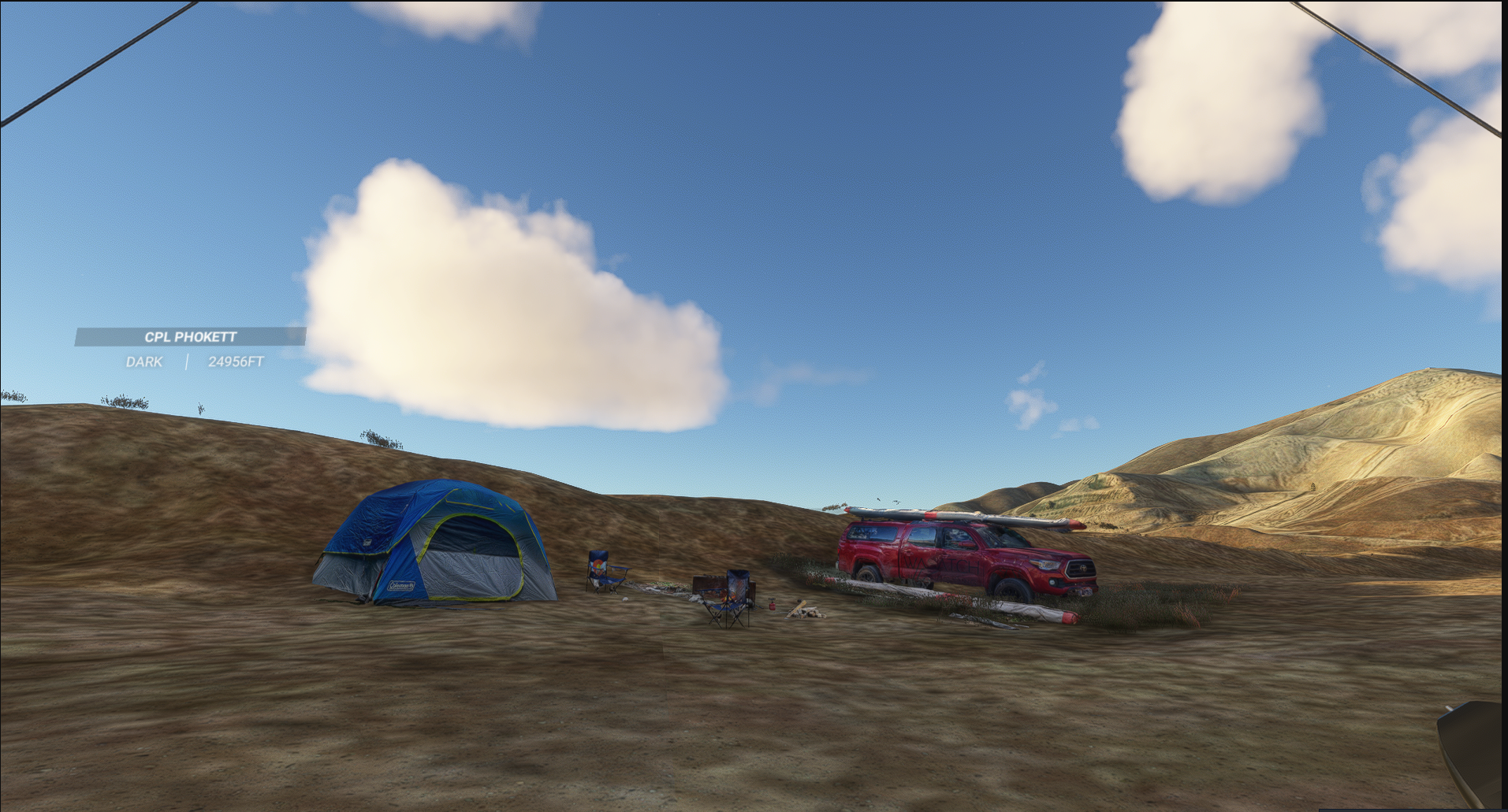
Located along NR-200, about 7 miles from highway 9. The drive up takes about 45 minutes due to serious road deterioration. Four wheel drive is required1. Elevation is 10,300’ MSL1. The setup area is adjacent to the road. Launch is about 100’ downhill from the setup area. The primary wind direction is southwest. Launches can occur with winds from about WSW to SW. Many times the winds appear to be coming straight in but are really wrapping from the west or northwest. There are several telltales in the area to help determine the true wind direction1.
Latitude: 39°54’26″N Longitude: 106°18’16″W
Lower Launch
Located along NR-200, about 3.5 miles from highway 9. You must park along the side of the road and carry your glider and gear about 100 yards along a path in the woods up to a small clearing on a knoll1. Elevation is 9,000’ MSL1. The primary wind direction is west1.
Latitude: 39°53’13″N Longitude: 106°16’33″W
Lake LZ
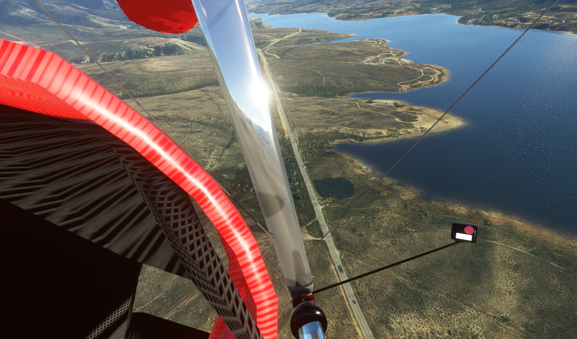
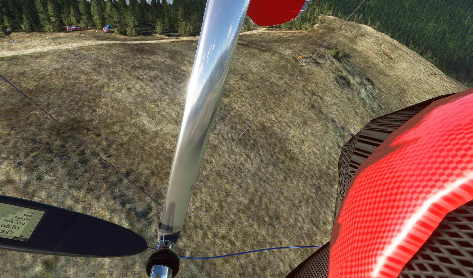
Located near the north end of Green Mountain Reservoir this LZ is between the highway and the lake shore. At times of the year when the lake is full the LZ can get narrow1. Elevation is 8,000’ MSL1. The winds in the LZ are typically from the west to northwest regardless of the launch wind direction. This allows for a landing that does not require aiming straight into the water. The LZ does slope downhill a bit toward the water so even if the wind is coming off of the water it is better to land in some crosswind to avoid ending up in the water1. Pilots should never cross the highway too low. There is a field on the other side of the highway if there is any doubt although landings there should be limited if you can make the lake LZ1.
Latitude: 39°52’55″N Longitude: 106°15’23″W
Postage Stamp LZ
Located next to NR-200 about 100 yards off of highway 9 the postage stamp is a rectangular area cleared of sage brush. This is the primary LZ if unable to get up off of the lower launch1.
Latitude: 39°53’11″N Longitude: 106°16’27″W
Flying Conditions and Restrictions
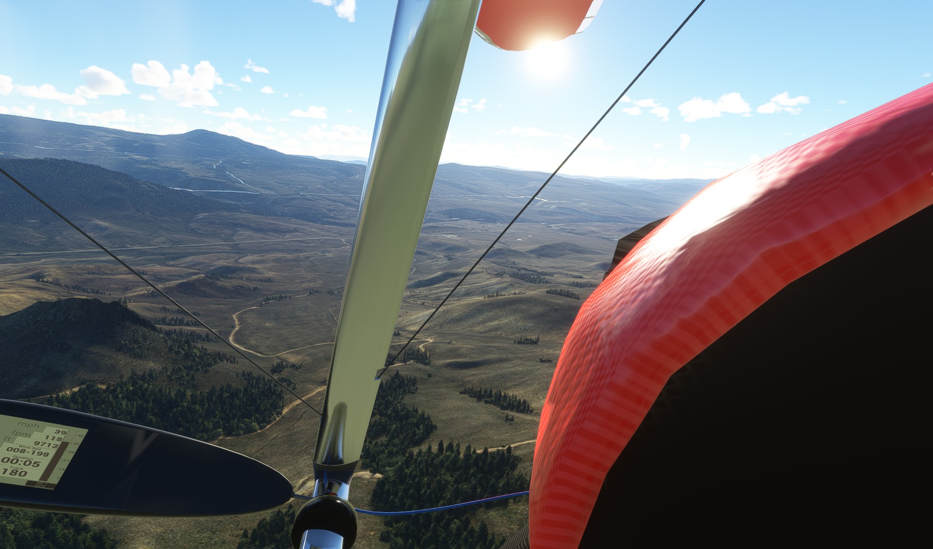
Williams Peak is a high-altitude site that requires strong launching skills and careful attention to the weather. The flying conditions vary depending on the time of day, the season, and the wind direction. Generally, the site offers smooth morning flights, strong thermal flights in the afternoon, and evening glass-offs with stunning views of the Gore Range1.
The upper launch is most popular with hang gliders and mornings. It faces south to southwest and provides sled rides of about 7 minutes to the lake LZ2. It is ideal for newer pilots and earlier morning flights when the conditions are calm1. However, it is not recommended to use this launch if the winds are trending to the west or northwest as the ridge line to the right can create significant rotor1. The upper launch also requires a 5:1 glide to reach the LZ, which can be difficult with any significant headwind1.
The lower launch is better for the evenings and for more experienced pilots. It faces west and allows for soaring and thermal flights in the afternoon2. Midday conditions require a H3 due to the more challenging thermal conditions2. The lower launch also has a smaller setup area and a longer carry from the road2.
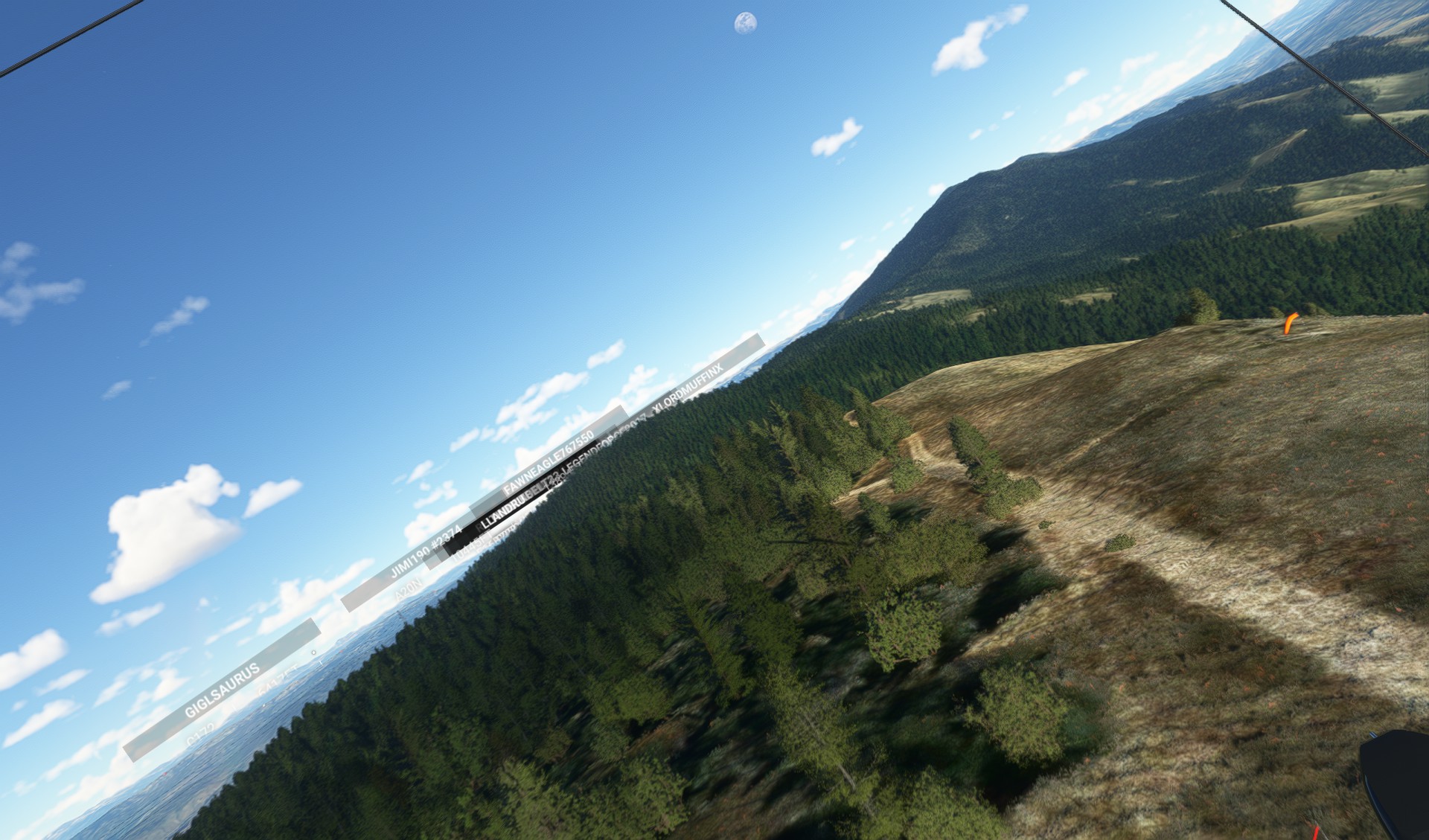
The dinosaur launch is another option if the winds are too north for the lower launch. It faces northwest and has a steep slope with rocks and trees1. It is only suitable for experienced pilots who can handle crosswind launches and landings1.
The main LZ is large easy target near the north end of Green Mountain Reservoir. They are between the highway and the lake shore2. The winds in the LZ are typically from the west to northwest regardless of the launch wind direction2. This allows for a landing that does not require aiming straight into the water. The LZ does slope downhill a bit toward the water so even if the wind is coming off of the water it is better to land in some crosswind to avoid ending up in the water2. Pilots should never cross the highway too low. There is a field on the other side of the highway if there is any doubt although landings there should be limited if you can make the lake LZ2. The bailout LZ is a tiny area next to NR-200 that is not recommended for hang gliders1.
The site has no specific restrictions, but pilots must follow USHPA rules and guidelines. RMHPA membership is required to fly at Williams Peak1. Pilots must also respect the landowner’s property and avoid landing or trespassing on private land. Pilots must also be aware of other air traffic in the area, such as helicopters, airplanes, or other gliders.
Best Times to Fly and Visit
The prime flying months for Williams Peak are from April to October, generally when the road has become dry enough to drive1. Winter flights are possible but may be sled or hiking access only2. Green Mountain Reservoir can serve as an accurate wind indicator to determine conditions near the LZ2.
The best time of day to fly depends on your skill level and preference. If you are a newer pilot or prefer smooth conditions, you can fly in the morning or late day under calm conditions from the upper launch1. If you are an experienced pilot or enjoy strong thermals, you can fly in the afternoon from the lower launch1. If you want to experience soaring flights in smoother sunset conditions, you can fly in the evening from either launch2.
The best time to visit Williams Peak is also dependent on your personal taste. The site offers stunning views of the mountains and the reservoir in any season. However, if you want to enjoy other activities besides flying, you may want to visit in the summer or fall when the weather is warmer and there are more options for hiking, biking, camping, fishing, boating, etc. The nearby town of Silverthorne also offers shopping, dining, and entertainment options for visitors3.
More Information
If you are interested in flying at Williams Peak, you will need to contact BJ Herring, the local instructor and site administrator. You can reach him at (303) 513-0998 or [email protected]1. He can provide you with more details about the site, the conditions, and the requirements. He can also offer tandem flights, lessons, and equipment rental if you need them1.
You can also visit the Hang Gliding Wiki page for Williams Peak2 or the Hang Gliding Files website3 for more information about the site history, geography, and record flights. You can also find some videos of flights from Williams Peak on YouTube.