Tolmezzo
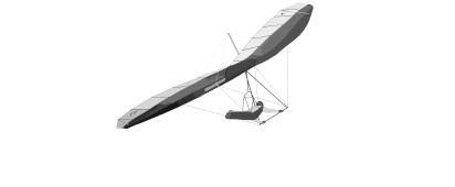
Specimen Sheet · Vital Statistics
Classification · Terrain & Access
Field chart.
§ 02 · Flying Conditions · Field NotesUpdated 2026·03·21
Located in the Friuli Venezia Giulia region of northeastern Italy, is a renowned hub for hang gliding enthusiasts. It serves as the headquarters for the 22nd FAI World Hang Gliding Class 1 Championship. This prestigious championship attracts highly experienced mountaineers and showcases the exhilarating sport of hang gliding.
The competition flying area around Tolmezzo spans diverse landscapes, from the sea to the Dolomites, crossing flatlands, the Alps, and the Prealps.
Has 1 different launch points. The best wind direction is 156.7 @ 10 knts but many sites can be flown from multiple directions, so check before you fly.
You can expect to find: thermal conditions cross country potential , all dependent on current weather conditions.
§ 03 · Wind Window · Best Operating EnvelopeSSE · 157° ±0°
Chase the Wind
Nearest weather station to Tolmezzo. Select any row to see which launches are in wind, then set your MSFS world clock to that UTC time.
Aviano, PN, IT
15:43 UTC
27 km from site
Wind
NNE 20°
8 kt
Ceiling
Clear
6+ sm vis
NNE 20° · 8 kt · 15:43 UTC
Select a time to check launches
Jan 21
Weather at , 27 km from Tolmezzo. Mountain conditions may differ — this is a clue, not a forecast. Adjust sim time on site until conditions feel right.
§ 07 · Location · Field CoordinatesWGS-84
§ 09 · Recent Flights · Log Book
No flights logged at Tolmezzo yet.
Be the first to fly here, upload your IGC file, and set the site records for others to chase. Every flight logged helps build the community data.
Upload a flight →