Cenes
Specimen Sheet · Vital Statistics
Classification · Terrain & Access
Field chart.
§ 02 · Flying Conditions · Field NotesUpdated 2026·03·21
This is a real site. Large and easy launch for all kind of pilots. Great surroundings near the Iberian Peninsula highest peak (Mulhacen) on Sierra Nevada mountains. Very busy on weekends with paragliding activity. Orientation from SW to NW.
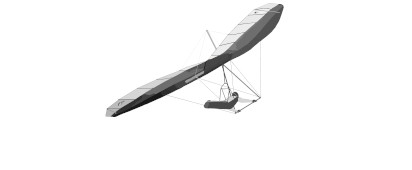
This site is a hang gliding site that you can fly in the real world. Has 2 different launch points. The best wind direction is 270 @ 220 knts but many sites can be flown from multiple directions, so check before you fly.
You can expect to find: cross country potential , all dependent on current weather conditions.
The wind starts at about 10h30-11h in spring. In summer, it is better to avoid flying between 14h and 17h-18h, sometimes later because the wind and thermiques are really strong. Very hard in summer. Suitable wind direction: SW, W, NW
§ 03 · Wind Window · Best Operating EnvelopeW · 270° ±0°
The wind starts at about 10h30-11h in spring. In summer, it is better to avoid flying between 14h and 17h-18h, sometimes later because the wind and thermiques are really strong. Very hard in summer. Suitable wind direction: SW, W, NW
Chase the Wind
Nearest weather station to Cenes. Select any row to see which launches are in wind, then set your MSFS world clock to that UTC time.
Granada/Armilla, AM, ES
15:43 UTC
10 km from site
Wind
Variable
2 kt
Ceiling
Clear
6+ sm vis
Variable · 2 kt · 15:43 UTC
Select a time to check launches
Jan 21
Weather at , 10 km from Cenes. Mountain conditions may differ — this is a clue, not a forecast. Adjust sim time on site until conditions feel right.
§ 07 · Location · Field CoordinatesWGS-84
§ 09 · Recent Flights · Log Book
No flights logged at Cenes yet.
Be the first to fly here, upload your IGC file, and set the site records for others to chase. Every flight logged helps build the community data.
Upload a flight →