North America · Colorado, USA
Telluride Ski Area
v1.0 · BETA
About
Telluride Ski Area is a high-altitude alpine hang gliding site governed by the Telluride Air Force (TAF), a non-profit organization that mandates a site orientation and Guide Pilot accompaniment for all visiting pilots — no exceptions, and flying without TAF authorization is a misdemeanor. Sitting at approximately 3,855m MSL in the San Juan Mountains of southwest Colorado, this is a serious, technical mountain flying environment with two distinct foot-launch points and at least one tow operation, demanding respect for altitude, complex terrain, and rapidly changing conditions. The site rewards experienced pilots with strong thermal potential and genuine XC opportunities in a visually spectacular high-alpine setting.
Launch Points (2)
Gold Hill Takeoff
use anywhere on the ridge you like

KTEX Telluride Airport
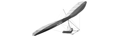
A generic hang glider launch

Landing Zones (2)
Main LZ
Just outside town. Very big area to land. Can be swampy in places some times.
Town Park LZ
Very restrictive. Advanced pilots only!
Flying Conditions
Winds are predominantly westerly, with the optimal window centered around 270° at 10–20 knots, and the high elevation means conditions can shift quickly and without much warning. Summer flying is subject to aggressive convective overdevelopment, with thunderstorms capable of building rapidly over the surrounding peaks by early afternoon — early launches are strongly advised. Fall is the preferred season for many local pilots, offering more stable, less turbulent air and extended soaring windows that can produce excellent cross-country conditions.
The terrain generates strong orographic lift and thermal activity off the rocky alpine slopes and ski area infrastructure, particularly as the sun heats the dark rock and south-facing aspects above treeline. Pilots should expect high-altitude thermal triggers to be energetic and sometimes broken, requiring active piloting and conservative decisions about entering the thermal core. XC potential extends into the broader San Juan range, with ridgelines and valley corridors offering route options for confident pilots, though landout terrain is rugged and sparse — thorough planning and a retrieve vehicle are essential. In MSFS, use the ski runs and exposed ridgelines as visual cues for lift sources, and treat any shadow-to-sun transition on rocky ground as a potential thermal trigger.
Terrain & Access
The launch areas sit well above treeline in classic high-alpine terrain, characterized by loose scree, exposed rock, and wide-open sightlines across the San Juan Mountains, with the manicured ski runs of the Telluride resort cutting through the steep flanks below. The surrounding landscape transitions from alpine tundra and rocky ridgelines near launch down through conifer forest into the deep, narrow canyon floor of the Telluride valley — a dramatic vertical environment that dominates every phase of flight.
Community Rating
1 rating
Sign in to rate this site.
Location
- Latitude
- 37.897227
- Longitude
- -107.822820
- Altitude
- 3,855 m / 12,648 ft
- Time Zone
- Mountain Standard Time
Conditions
- Min Hang Rating
- H4
- Best Wind Dir
- W (270°)
- Best Wind Speed
- 10–20 kt
- Weather Station
- KTEX
Chase the Wind
Nearest weather station to Telluride Ski Area. Select any row to see which launches are in wind, then set your MSFS world clock to that UTC time.
Telluride Rgnl, CO, US
13:26 UTC
10 km from site
Wind
S 180°
15 G23 kt
Ceiling
Clear
10+ sm vis
S 180° · 15 G23 kt · 13:26 UTC
Select a time to check launches
Jan 21
Weather at , 10 km from Telluride Ski Area. Mountain conditions may differ — this is a clue, not a forecast. Adjust sim time on site until conditions feel right.